TASMANIA (VK7)
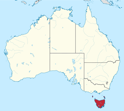
Tasmania, abbreviated as TAS, and also known colloquially as 'Tassie' is an island state, part of the Commonwealth of Australia. It is located 240 kms (150 miles) to the south of the Australian continent, separated by Bass Strait. The State of Tasmania includes the island of Tasmania, the 26th largest in the world, and the surrounding 334 islands. The State has a population of about 508,000 people. The state capital and largest city is Hobart.
Almost 37 % of Tasmania lies in reserves, national parks and World Heritage Sites.
Tasmania has a total of 19 National Parks.
Almost 37 % of Tasmania lies in reserves, national parks and World Heritage Sites.
Tasmania has a total of 19 National Parks.
TASMANIA FAUNA EMBLEM.
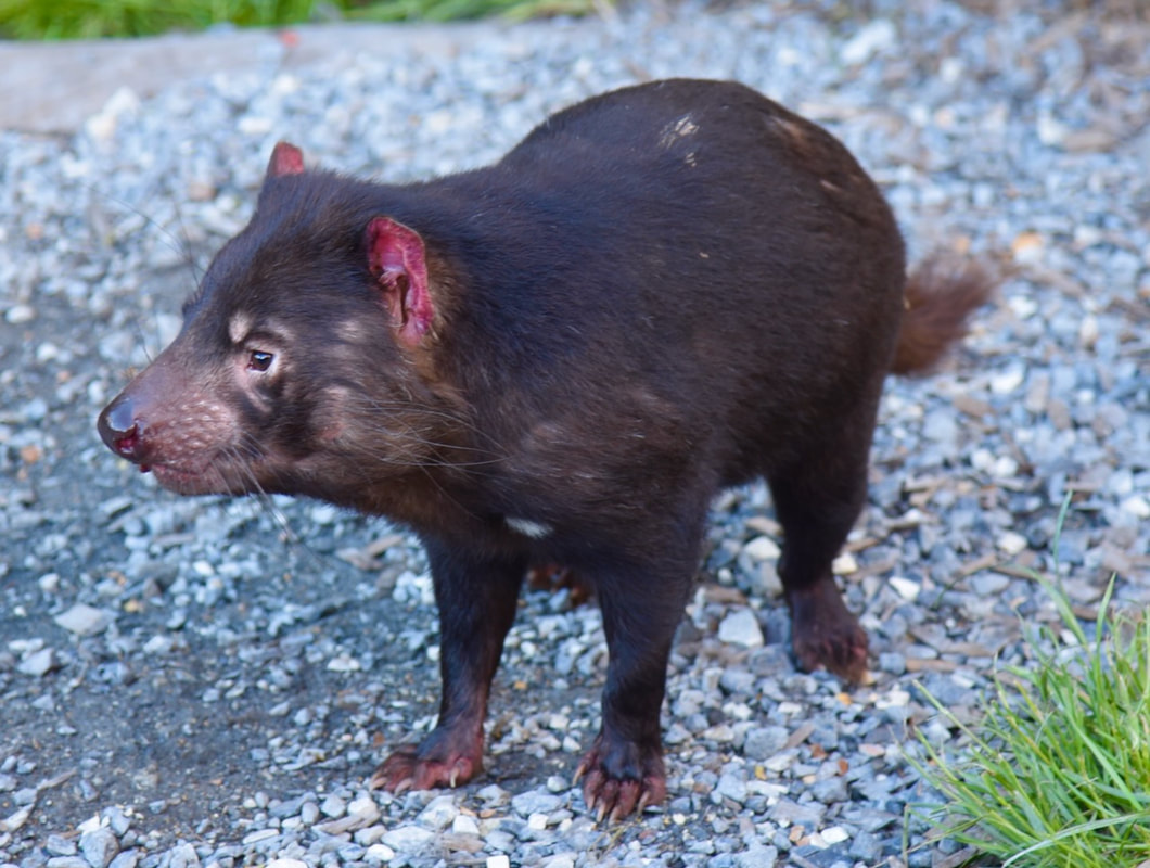
Image c/o Paul VK5PAS
|
Tasmanian Devil |
TASMANIA FLORA EMBLEM.
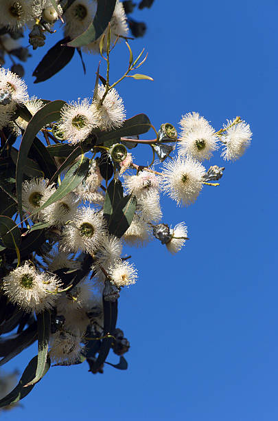
Image c/o iStock
|
Tasmanian Blue Gum |
TASMANIA STATE FLAG.

TASMANIA COAT OF ARMS.

PARKS & WILDLIFE SERVICE TASMANIA.
Reserves are declared under the Nature Conservation Act 2002. This sets out the the values and purposes of each reserve class and is managed under the National Parks and Reserves Management Act 2002. Together these two Acts replace the National Parks and Wildlife Act 1970.
In total, the Tasmanian Parks and Wildlife Service (PWS) manages 806 reserves covering about 2.86 million hectares, or about 40% of the land area of the State, excluding marine areas.
The Tasmanian Reserve Estate includes a further 135,400 hectares in Marine Protected Areas (MPAs), of which Macquarie Island MPA is 74,700 hectares. There are a further 53,700 hectares under reserve in other areas of the marine and estuarine environments.
The Parks and Wildlife Service also assists in the protection of private land that is declared as Private Nature Reserves, Private Sanctuaries and Areas Covenanted for Conservation.
The total, the Tasmanian Reserve Estate as at at 30th June 2022 indicates a total reserved area of 3,622,200 hectares, including formal and informal reserves on public land, reserves on private land, and Marine Protected Areas (MPAs). The terrestrial reserved area is 3,429,000 hectares, or 50.4% of the area of Tasmania.
More info can be found at the Tasmania Parks and Wildlife Service website.

TYPES OF PARKS IN TASMANIA.
- National Park
- "A large natural area of land containing a representative or outstanding sample of major natural regions, features of scenery."
- State Reserve
- "An area of land containing any of the following: significant natural landscapes; natural features; sites, objects or places of significance to Aboriginal people."
- Nature Reserve
- "An area of land that contains natural values that contribute to the natural biological diversity or geological diversity of the area of land, or both, and are unique, important or have representative value."
- Game Reserve
- "An area of land containing natural values that are unique, important or have repsentative value particularly with respect to game species".
- Conservation Area
- "An area of land predominantly in a natural state."
- Nature Recreation Area
- "An area of land predominantly in a natural state; or containing sensitve natural sites of significance for recreation."
- Regional Reserve
- "An area of land with high mineral potential or prospectivity, and predominantly in a natural state."
- Historic Site
- "An area of land of significance for historic cultural heritage".
- Private Nature Reserve
- "An area of land that contains natural values that (a) contirbute to the natural biological diversity or geological diversity of the area of land, or both, and (b) are unique, important or have representative value".
- Private Sanctuary
- "An area of land that has significant natural or cultural values, or both".
- Marine Reserve
QUALIFYING PARKS IN TASMANIA.
There are currently 322 parks in Tasmania which qualify for WWFF (as of 13th February 2024).
They consist of:
They consist of:
- Conservation Covenant - 43
- Conservation Area - 114
- Nature Reserve - 7
- State Reserve - 65
- Regional Reserve - 46
- National Park - 19
- Nature Recreation Area - 18
- Historic SIte - 1
- Private Sanctuary - 1
- Bushland Reserve - 1
- Conservation Reserve - 1
- Nature Refuge - 5
- Game Reserve - 1
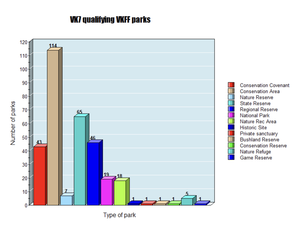
Above:- Graph showing the types of parks in Tasmania.
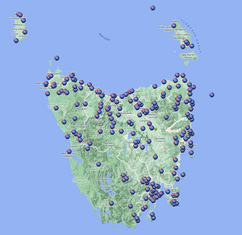
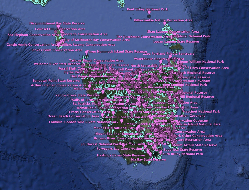
Above:- Map showing qualifying VK7 VKFF parks. Map c/o https://www.cqgma.org/
A LIST OF QUALIFYING VK7 PARKS.
- Acacia Hills Conservation Covenant VKFF-4339
- Alma Tier Conservation Area VKFF-3334
- Alma Tier Nature Reserve VKFF-3335
- Alum Cliffs State Reserve VKFF-1790
- Ansons Bay Conservation Area VKFF-3336
- Apex Point Conservation Area VKFF-4308
- Apslawn Regional Reserve VKFF-3337
- Apsley Conservation Area VKFF-3338
- Arthur River Conservation Area VKFF-3339
- Arthur-Pieman Conservation Area VKFF-1132
- Avoca Regional Reserve VKFF-4390
- Bangor Conservation Covenant VKFF-4340
- Bay of Fires Conservation Area VKFF-1133
- Bellettes Bay Conservation Area VKFF-4309
- Bells Marsh Regional Reserve VKFF-3340
- Ben Lomond National Park VKFF-0028
- Black Bluff Nature Recreation Area VKFF-4381
- Black Jack Regional Reserve VKFF-4391
- Black River Conservation Area VKFF-3341
- Blue Tier Regional Reserve VKFF-3342
- Blythe River Conservation Area VKFF-3343
- Bogan Road Conservation Covenant VKFF-4341
- Bond Tier Regional Reserve VKFF-3344
- Bonneys Tier Regional Reserve VKFF-4392
- Boobyalla Conservation Area VKFF-3345
- Bouchers Creek Conservation Area VKFF-4310
- Bradys Lake Conservation Covenant VKFF-4342
- Bradys Lookout State Reserve VKFF-1791
- Briant Hill Nature Recreation Area VKFF-3346
- Bridgenorth Conservation Area VKFF-3347
- Brighton Racecourse Conservation Covenant VKFF-4343
- Brown Mountain Conservation Area VKFF-3348
- Browns River Conservation Covenant VKFF-4344
- Buster Road Melrose Conservation Covenant VKFF-4345
- Calm Bay State Reserve VKFF-1792
- Calm River Conservation Area VKFF-4311
- Calverts Hill Nature Refuge VKFF-4385
- Calverts Lagoon Conservation Area VKFF-2897
- Cameron Regional Reserve VKFF-3349
- Cape Bernier Nature Reserve VKFF-3350
- Cape Deslacs Nature Reserve VKFF-2930
- Cape Portland Conservation Area VKFF-3351
- Cape Wickham State Reserve VKFF-1134
- Caroline Creek Conservation Covenant VKFF-4346
- Caroline Creek Regional Reserve VKFF-4393
- Carr Villa Conservation Area VKFF-3352
- Cataraqui Point Conservation Area VKFF-4409
- Central Plateau Conservation Area VKFF-1158
- Chauncey Vale Conservation Area VKFF-4312
- Cherry Tree Hill Nature Reserve VKFF-3353
- Christmas Hills Conservation area VKFF-4313
- Chronicle Point Conservation Area VKFF-4314
- City of Melbourne Bay Conservation Area VKFF-4410
- Clifton Beach Conservation Area VKFF-3354
- Coal Hill Rd South Spreyton Conservation Covenant VKFF-4347
- Cockers Creek Conservation Covenant VKFF-4348
- Coles Bay Conservation Area VKFF-2898
- Colliers Swamp Conservation Area VKFF-4411
- Coningham Nature Recreation Area VKFF-1135
- Counsel Hill Conservation Area VKFF-4412
- Cradle Mountain-Lake St Clair National Park VKFF-0117
- Crayfish Creek Regional Reserve VKFF-4394
- Cressy Beach Conservation Area VKFF-2899
- Crotty Conservation Area VKFF-3355
- Crotty Ridge Regional Reserve VKFF-3356
- Dart Island State Reserve VKFF-1793
- Den Hill Conservation Area VKFF-4315
- Denison Ridge Conservation Area VKFF-2900
- Denison Rivulet Conservation Area VKFF-2901
- Derwent Cliffs State Reserve VKFF-1794
- Detention Falls Conservation Area VKFF-3357
- Devils Gullet State Reserve VKFF-1795
- Dial Range Regional Reserve VKFF-4395
- Dip Falls Regional Reserve VKFF-2934
- Disappointment Bay State Reserve VKFF-1796
- Dismal Swamp Regional Reserve VKFF-3358
- Doctors Rocks Conservation Area VKFF-2902
- Don Heads Conservation Area VKFF-2903
- Douglas-Apsley National Park VKFF-0145
- Drivers Run Conservation Covenant VKFF-4349
- Duck River Conservation Area VKFF-3359
- Duck River Regional Reserve VKFF-4396
- Duckhole Rivulet Richmond Conservation Covenant VKFF-4350
- Eaglehawk Bay State Reserve VKFF-1797
- Eaglehawk Bay-Flinders Bay Conservation Area VKFF-4316
- East Risdon State Reserve VKFF-1798
- Echo Sugarloaf State Reserve VKFF-1799
- Eddystone Point Lighthouse Historic Site VKFF-3360
- Eldorado Conservation Area VKFF-4413
- Emu River Conservation Area VKFF-4317
- Emu River Regional Reserve VKFF-4397
- Eugenana State Reserve VKFF-1800
- Evercreech Regional Reserve VKFF-4398
- Fairy Glade State Reserve VKFF-1801
- Fanfare Angora Stud Conservation Covenant VKFF-4351
- Fern Glade Conservation Area VKFF-2924
- Fern Tree Conservation Covenant VKFF-4352
- Ferndene State Reserve VKFF-1802
- Fire Tower Rd Koonya Conservation Covenant VKFF-4353
- Forest Vale State Reserve VKFF-1803
- Forth Falls State Reserve VKFF-1804
- Forwards Beach Conservation Area VKFF-4318
- Fossil Bluff Conservation Covenant VKFF-4319
- Four Mile Creek Conservation Area VKFF-2904
- Franklin-Gordon Wild Rivers National Park VKFF-0185
- Freycinet National Park VKFF-0188
- Friendly Beaches Conservation Reserve VKFF-3361
- Gellibrand Point Nature Recreation Area VKFF-2927
- Gentle Annie Conservation Area VKFF-4414
- German Town Regional Reserve VKFF-2935
- Glebe Hill Conservation Covenant VKFF-4354
- Glenfern Conservation Covenant VKFF-4355
- Gordons Hill Nature Recreation Area VKFF-4382
- Goulds Lagoon Conservation Area VKFF-4335
- Granite Point Conservation Area VKFF-1136
- Great Lake Conservation Area VKFF-3362
- Great Musselroe River Conservation Area VKFF-3363
- Great Western Tiers Conservation Area VKFF-2905
- Greens Beach Conservation Area VKFF-2906
- Gunns Plains Cave State Reserve VKFF-1137
- Hardings Falls Regional Reserve VKFF-3364
- Hartz Mountains National Park VKFF-0227
- Hastings Caves State Reserve VKFF-1138
- Hawley Nature Refuge VKFF-4386
- Hazelwood Conservation Covenant VKFF-4356
- Hellyer Gorge State Reserve VKFF-1139
- Henry Somerset Private Sanctuary VKFF-2933
- Henty Glacial Erratics State Reserve VKFF-1805
- Highland Lakes Rd Golden Valley Conservation Covenant VKFF-4357
- Holwell Gorge State Reserve VKFF-1806
- Humbug Point Nature Recreation Area VKFF-1140
- Ida Bay State Reserve VKFF-1807
- Iron Pot State Reserve VKFF-1808
- Jordan Nature Refuge VKFF-4387
- Junee Cave State Reserve VKFF-1809
- Kate Reed Nature Recreation Area VKFF-1141
- Kent Group National Park VKFF-0260
- Killiecrankie Nature Recreation Area VKFFF-3365
- Kimberley Springs State Reserve VKFF-1810
- King Island Conservation Covenant VKFF-3366
- Knopwood Hill Nature Recreation Area VKFF-4383
- Krahenbuhl Conservation Covenant VKFF-4358
- Lady Binney Regional Reserve VKFF-4399
- Lake Barrington Nature Recreation Area VKFF-3367
- Lake Dulverton Conservation Area VKFF-2907
- Lake Leake Conservation Area VKFF-4336
- Lavinia State Reserve VKFF-1142
- Leven Canyon Regional Reserve VKFF-2936
- Liawenee Conservation Area VKFF-4320
- Liffey Falls State Reserve VKFF-1143
- Lime Bay State Reserve VKFF-1144
- Limekiln Creek Conservation Area VKFF-4321
- Little Beach State Reserve VKFF-1811
- Little Peggs Beach State Reserve VKFF-1812
- Little Pine Lagoon Conservation Area VKFF-4322
- Logan Lagoon State Reserve VKFF-1813
- Long Bay Conservation Area VKFF-4323
- Long Hill Conservation Area VKFF-4324
- Long Ridge Regional Reserve VKFF-4400
- Lookout Rock State Reserve VKFF-1814
- Lost Falls Conservation Area VKFF-2908
- Low Head Conservation Area VKFF-2909
- MacLaines Creek Conservation Area VKFF-3368
- Malwood-Rokeby Hills Conservation Covenant VKFF-4359
- Maria Island National Park VKFF-0305
- Marriotts Falls State Reserve VKFF-1815
- Marshlands Conservation Covenant VKFF-4360
- Mathinna Falls Regional Reserve VKFF-3369
- Meehan Range Nature Recreation Area VKFF-3370
- Meetus Falls Conservation Area VKFF-2910
- Mersey Bluff State Reserve VKFF-1816
- Milkshake Hills Regional Reserve VKFF-2937
- Millvale Rd Dromedary Conservation Covenant VKFF-4361
- Mole Creek Karst National Park VKFF-0322
- Molesworth Conservation Area VKFF-3371
- Morass Bay Conservation Area VKFF-2911
- Moulting Lagoon Game Reserve VKFF-4380
- Mount Arthur State Reserve VKFF-1817
- Mount Barrow State Reserve VKFF-1818
- Mount Barrow Falls State Reserve VKFF-1819
- Mount Dial Nature Recreation Area VKFF-3372
- Mount Direction Conservation Area VKFF-3373
- Mount Dromedary Conservation Area VKFF-3374
- Mount Dundas Regional Reserve VKFF-3375
- Mount Faulkner Conservation Area VKFF-3376
- Mount Field National Park VKFF-0347
- Mount Heemskirk Regional Reserve VKFF-4401
- Mount Montgomery Nature Recreation Area VKFF-4384
- Mount Montgomery State Reserve VKFF-1820
- Mount Pearson State Reserve VKFF-1821
- Mount Roland Regional Reserve VKFF-2938
- Mount Rumney Conservation Area VKFF-2912
- Mount Stronach Regional Reserve VKFF-3377
- Mount Victoria Regional Reserve VKFF-3378
- Mount William National Park VKFF-0366
- Mountain Road Lilydale Conservation Covenant VKFF-4362
- Murphys Flat Conservation Area VKFF-3379
- Musselroe Bay Conservation Area VKFF-3380
- Narawntapu National Park VKFF-0005
- Native Point Nature Reserve VKFF-2931
- Norfolk Bay Conservation Area VKFF-4325
- North Passage Point Conservation Area VKFF-4326
- North Scotsdale Regional Reserve VKFF-3381
- Notley Gorge State Reserve VKFF-1145
- Nunamara Regional Reserve VKFF-3382
- Ocean Beach Conservation Area VKFF-3383
- Parting Creek Regional Reserve VKFF-3384
- Peggs Beach Conservation Area VKFF-2913
- Pennicottage Conservation Covenant VKFF-4363
- Peter Murrell Conservation Area VKFF-3385
- Peter Murrell State Reserve VKFF-1146
- Pieman River State Reserve VKFF-1822
- Pipers River Regional Reserve VKFF-4402
- Pirates Bay Nature Recreation Area VKFF-3386
- Pitt Water Nature Refuge VKFF-4388
- Porcupine Hill Regional Reserve VKFF-4403
- Porky Beach Conservation Area VKFF-4415
- Port Sorell Conservation Area VKFF-2914
- Porter Hill Conservation Covenant VKFF-4364
- Powranna Nature Reserve VKFF-3387
- Princess River Conservation Area VKFF-3388
- Promised Land Regional Reserve VKFF-2939
- Prossers Regional Reserve VKFF-4404
- Punchbowl Conservation Area VKFF-3389
- Quamby Bluff Conservation Area VKFF-4327
- Quarantine Station State Reserve VKFF-1823
- Rainbow Point Conservation Area VKFF-4328
- Ralphs Bay Conservation Area VKFF-4329
- Rathmolyn Conservation Covenant VKFF-4365
- Ravenswood Bushland Reserve VKFF-3390
- Redbill Point Conservation Area VKFF-3391
- Reedy Marsh Conservation Area VKFF-4330
- Remarkable Rock Conservation Area VKFF-4331
- Renison Bell Regional Reserve VKFF-4405
- Ringarooma River Regional Reserve VKFF-4406
- Ringwood Conservation Covenant VKFF-4366
- Risdon Peppermint Reserve Conservation Covenant VKFF-4367
- Rocky Cape National Park VKFF-0432
- Roger River State Reserve VKFF-1824
- Rosny Hill Nature Recreation Area VKFF-2928
- Rothamay Conservation Covenant VKFF-4368
- Royal George Regional Reserve VKFF-4407
- Rubicon Sanctuary Conservation Covenant VKFF-4369
- Saddlers Run Conservation Covenant VKFF-4370
- Safety Cove State Reserve VKFF-1825
- Savage River National Park VKFF-0443
- Scamander Conservation Area VKFF-1147
- Sea Elephant Conservation Area VKFF-4416
- Seal Rocks Conservation Area VKFF-4417
- Seal Rocks State Reserve VKFF-1148
- Seymour Conservation Area VKFF-3392
- Shag Lagoon Conservation Area VKFF-2915
- Shingle Hill Conservation Area VKFF-2916
- Sidmouth Conservation Area VKFF-3393
- Skemps Myrtle Bank Conservation Covenant VKFF-3394
- Slaves Bay Conservation Area VKFF-2917
- Sliaba Run Conservation Covenant VKFF-4371
- Snow Hill Regional Reserve VKFF-4408
- Snug Tiers Nature Recreation Area VKFF-1149
- South Arm Conservation Area VKFF-4332
- South Arm Nature Recreation Area VKFF-2929
- South Bruny National Park VKFF-0456
- South Esk Regional Reserve VKFF-3395
- South Lea-Peppermint Hill Conservation Covenant VKFF-4372
- Southport Lagoon Conservation Area VKFF-1150
- Southwest National Park VKFF-0461
- Spiky Beach Conservation Area VKFF-2918
- St Columba Falls State Reserve VKFF-1151
- St Helens Conservation Area VKFF-1153
- St Marys Pass State Reserve VKFF-1152
- St Patricks Head State Reserve VKFF-1826
- St Patricks Plains Conservation Covenant VKFF-4373
- Stanley Conservation Area VKFF-2919
- Stewarts Bay State Reserve VKFF-1827
- Stokes Point Conservation Area VKFF-4418
- Strzelecki National Park VKFF-0469
- Sugarloaf Road Forcett Conservation Covenant VKFF-4374
- Summerhill Drive Port Sorell Conservation Covenant VKFF-4375
- Sundown Point State Reserve VKFF-1828
- Surveyors Bay Conservation Area VKFF-2920
- Swan River Regional Reserve VKFF-3396
- Swansea Conservation Area VKFF-3397
- Table Cape State Reserve VKFF-1829
- Tailers Bay Conservation Area VKFF-4333
- Tamar Conservation Area VKFF-1154
- Tarraleah Conservation Area VKFF-4334
- Tasman National Park VKFF-0481
- Tatlows Beach Conservation Area VKFF-2921
- Tea-Tree Bay Conservation Area VKFF-2922
- Tessellated Pavement State Reserve VKFF-1830
- The Dutchman Conservation Area VKFF-2923
- The Lea Conservation Area VKFF-3398
- The Nut State Reserve VKFF-1831
- The Nutshell Conservation Covenant VKFF-4376
- The Steppes State Reserve VKFF-1832
- Three Hummock Island State Reserve VKFF-1833
- Three Sisters-Goat Island Nature Refuge VKFF-4389
- Three Thumbs State Reserve VKFF-1834
- Tom Gibson Nature Reserve VKFF-1155
- Trevallyn Nature Recreation Area VKFF-1156
- Trial Harbour State Reserve VKFF-1835
- Trowutta Caves State Reserve VKFF-1836
- Truganini Conservation Area VKFF-3399
- Two Springs and Tiny's Bush Conservation Covenant VKFF-4377
- Vale of Belvoir Conservation Area VKFF-2925
- Walls of Jerusalem National Park VKFF-0513
- Waratah Creek Regional Reserve VKFF-3400
- Warragul Farm Conservation Covenant VKFF-4378
- Warrawee Conservation Area VKFF-4337
- Waterfall Creek State Reserve VKFF-1837
- Waterhouse Conservation Area VKFF-1157
- Welcome River State Reserve VKFF-1838
- Welcome Swamp Regional Reserve VKFF-3401
- Weldborough Pass State Reserve VKFF-1839
- Wellington Park Conservation Area VKFF-2932
- Wessing Lane Collinsvale Conservation Covenant VKFF-4379
- West Point State Reserve VKFF-1840
- Whalers Lookout Conservation Area VKFF-2926
- Winterbrook Falls Regional Reserve VKFF-3402
- Wye River State Reserve VKFF-1841
- Wyre Forest Creek Conservation Area VKFF-4338
- Yellow Creek State Reserve VKFF-1842
HOW TO FIND WHERE THE QUALIFYING VKFF PARKS ARE IN TASMANIA.
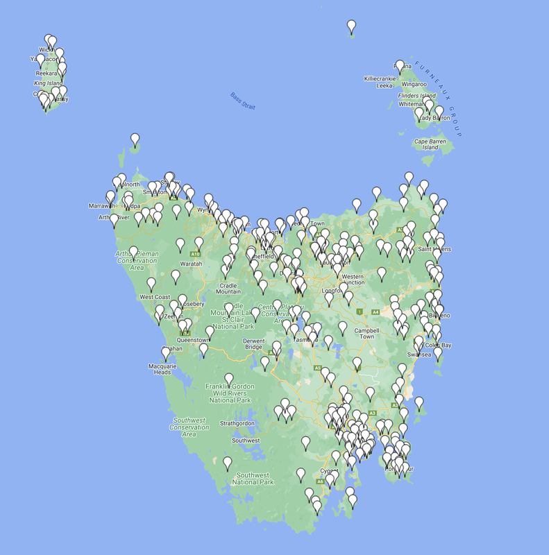
Use the KML file below to upload to either Google Earth or My Google Maps, to show you the location of the VK7 VKFF qualifying parks (current as of 13th February 2024).
| vk7_vkff_parks_as_of_13022024.kml |
EXTRA INFORMATION.
- Narawntapu National Park was formerly known as Asbestos Range National Park.
WWFF HISTORY IN VK7.
11th February 2024:
A total of 101 new parks were added to the WWFF Directory.
Apex Point Conservation Area VKFF-4308 - Snow Hill Regional Reserve VKFF-4408.
A total of 101 new parks were added to the WWFF Directory.
Apex Point Conservation Area VKFF-4308 - Snow Hill Regional Reserve VKFF-4408.
13th March 2023:
A total of 69 new parks were added to the WWFF Directory.
Alma Tier Conservation Park VKFF-3334 - Winterbrook Falls Regional Reserve VKFF-3402.
A total of 69 new parks were added to the WWFF Directory.
Alma Tier Conservation Park VKFF-3334 - Winterbrook Falls Regional Reserve VKFF-3402.
- VKFF-3334 Alma Tier Conservation Area
- VKFF-3335 Alma Tier Nature Reserve
- VKFF-3336 Ansons Bay Conservation Area
- VKFF-3337 Apslawn Regional Reserve
- VKFF-3338 Apsley Conservation Area
- VKFF-3339 Arthur River Conservation Area
- VKFF-3340 Bells Marsh Regional Reserve
- VKFF-3341 Black River Conservation Area
- VKFF-3342 Blue Tier Regional Reserve
- VKFF-3343 Blythe River Conservation Area
- VKFF-3344 Bond Tier Regional Reserve
- VKFF-3345 Boobyalla Conservation Area
- VKFF-3346 Briant Hill Nature Recreation Area
- VKFF-3347 Bridgenorth Conservation Area
- VKFF-3348 Brown Mountain Conservation Area
- VKFF-3349 Cameron Regional Reserve
- VKFF-3350 Cape Bernier Nature Reserve
- VKFF-3351 Cape Portland Conservation Area
- VKFF-3352 Carr Villa Conservation Area
- VKFF-3353 Cherry Tree Hill Nature Reserve
- VKFF-3354 Clifton Beach Conservation Area
- VKFF-3355 Crotty Conservation Area
- VKFF-3356 Crotty Ridge Regional Reserve
- VKFF-3357 Detention Falls Conservation Area
- VKFF-3358 Dismal Swamp Regional Reserve
- VKFF-3359 Duck River Conservation Area
- VKFF-3360 Eddystone Point Lighthouse Historic Site
- VKFF-3361 Friendly Beaches Conservation Reserve
- VKFF-3362 Great Lake Conservation Area
- VKFF-3363 Great Musselroe River
- VKFF-3364 Hardings Falls Regional Reserve
- VKFF-3365 Killiecrankie Nature Recreation Area
- VKFF-3366 King Island Conservation Covenant
- VKFF-3367 Lake Barrington Nature Recreation Area
- VKFF-3368 MacLaines Creek Conservation Area
- VKFF-3369 Mathinna Falls Regional Reserve
- VKFF-3370 Meehan Range Nature Recreation Area
- VKFF-3371 Molesworth Conservation Area
- VKFF-3372 Mount Dial Nature Recreation Area
- VKFF-3373 Mount Direction Conservation Area
- VKFF-3374 Mount Dromedary Conservation Area
- VKFF-3375 Mount Dundas Regional Reserve
- VKFF-3376 Mount Faulkner Conservation Area
- VKFF-3377 Mount Stronach Regional Reserve
- VKFF-3378 Mount Victoria Regional Reserve
- VKFF-3379 Murphys Flat Conservation Area
- VKFF-3380 Musselroe Bay Conservation Area
- VKFF-3381 North Scottsdale Regional Reserve
- VKFF-3382 Nunamara Regional Reserve
- VKFF-3383 Ocean Beach Conservation Area
- VKFF-3384 Parting Creek Regional Reserve
- VKFF-3385 Peter Murrell Conservation Area
- VKFF-3386 Pirates Bay Nature Recreation Area
- VKFF-3387 Powranna Nature Reserve
- VKFF-3388 Princess River Conservation Area
- VKFF-3389 Punchbowl Reserve
- VKFF-3390 Ravenswood Bushland Reserve
- VKFF-3391 Redbill Point Conservation Area
- VKFF-3392 Seymour Conservation Area
- VKFF-3393 Sidmouth Conservation Area
- VKFF-3394 Skemps Myrtle Bank
- VKFF-3395 South Esk Regional Reserve
- VKFF-3396 Swan River Regional Reserve
- VKFF-3397 Swansea Conservation Area
- VKFF-3398 The Lea Conservation Area
- VKFF-3399 Truganini Conservation Area
- VKFF-3400 Waratah Creek Regional Reserve
- VKFF-3401 Welcome Swamp Regional Reserve
- VKFF-3402 Winterbrook Falls Regional Reserve
24th April 2019:
A total of 43 parks were added to the WWFF Directory.
A total of 43 parks were added to the WWFF Directory.
- Calverts Lagoon Conservation Area VKFF-2897
- Coles Bay Conservation Area VKFF-2898
- Cressy Beach Conservation Area VKFF-2899
- Denison Ridge Conservation Area VKFF-2900
- Denison Rivulet Conservation Area VKFF-2901
- Doctors Rocks Conservation Area VKFF-2902
- Don Heads Conservation Area VKFF-2903
- Four Mile Creek Conservation Area VKFF-2904
- Great Western Tiers Conservation Area VKFF-2905
- Greens Beach Conservation Area VKFF-2906
- Lake Dulverton Conservation Area VKFF-2907
- Lost Falls Conservation Area VKFF-2908
- Low Head Conservation Area VKFF-2909
- Meetus Falls Conservation Area VKFF-2910
- Morass Bay Conservation Area VKFF-2911
- Mount Rumney Conservation Area VKFF-2912
- Peggs Beach Conservation Area VKFF-2913
- Port Sorell Conservation Area VKFF-2914
- Shag Lagoon Conservation Area VKFF-2915
- Shingle Hill Conservation Area VKFF-2916
- Slaves Bay Conservation Area VKFF-2917
- Spiky Beach Conservation Area VKFF-2918
- Stanley Conservation Area VKFF-2919
- Surveyors Bay Conservation Area VKFF-2920
- Tatlows Beach Conservation Area VKFF-2921
- Tea-Tree Conservation Area VKFF-2922
- The Dutchman Conservation Area VKFF-2923
- Fern Glade Conservation Area VKFF-2924
- Vale of Belvoir Conservation Area VKFF-2925
- Whalers Lookout Conservation Area VKFF-2926
- Gellibrand Point Nature Recreation Area VKFF-2927
- Rosny Hill Nature Recreation Area VKFF-2928
- South Arm Nature Recreation Area VKFF-2929
- Cape Deslacs Nature Reserve VKFF-2930
- Native Point Nature Reserve VKFF-2931
- Wellington Point Conservation Area VKFF-2932
- Henry Somerset Private Sanctuary VKF-2933
- Dip Falls Regional Reserve VKFF-2934
- German Town Regional Reserve VKFF-2935
- Leven Canyon Regional Reserve VKFF-2936
- Milkshake Hills Regional Reserve VKFF-2937
- Mount Roland Regional Reserve VKFF-2938
- Promised Land Regional Reserve VKFF-2939
11th July 2017:
The following State Reserves were added to the WWFF Directory:
The following State Reserves were added to the WWFF Directory:
- Alum Cliffs VKFF-1790
- Bradys Lookout VKFF-1791
- Calm Bay VKFF-1792
- Dart Island VKFF-1793
- Derwent Cliffs VKFF-1794
- Devils Gullet VKFF-1795
- Disappointment Bay VKFF-1796
- Eaglehawk Bay VKFF-1797
- East Risdon VKFF-1798
- Echo Sugarloaf VKFF-1789
- Eugenana VKFF-1800
- Fairy Glade VKFF-1801
- Ferndene VKFF-1802
- Forest Vale VKFF-1803
- Forth Falls VKFF-1804
- Henty Glacial Erratics VKFF-1805
- Holwell Gorge VKFF-1806
- Ida Bay VKFF-1807
- Iron Pot VKFF-1808
- Junee Cave VKFF-1809
- Kimberley Springs VKFF-1810
- Little Beach VKFF-1811
- Little Peggs Beach VKFF-1812
- Logan Lagoon VKFF-1813
- Lookout Rock VKFF-1814
- Marriotts Falls VKFF-1815
- Mersey Bluff VKFF-1816
- Mount Arthur VKFF-1817
- Mount Barrow VKFF-1818
- Mount Barrow Falls VKFF-1819
- Mount Montgomery VKFF-1820
- Mount Pearson VKFF-1821
- Pieman River VKFF-1822
- Quarantine Station VKFF-1823
- Roger River VKFF-1824
- Safety Cove VKFF-1825
- St Patricks Head VKFF-1826
- Stewarts Bay VKFF-1827
- Sundown Point VKFF-1828
- Table Cape VKFF-1829
- Tessellated Pavement VKFF-1830
- The Nut VKFF-1831
- The Steppes VKFF-1832
- Three Hummock Island VKFF-1833
- Three Thumbs VKFF-1834
- Trial Harbour VKFF-1835
- Trowutta Caves VKFF-1836
- Waterfall Creek VKFF-1837
- Welcome River VKFF-1838
- Weldborough Pass VKFF-1839
- West Point VKFF-1840
- Wye River VKFF-1841
- Yellow Creek VKFF-1842
21st February 2016:
A total of 27 new parks were added to the WWFF Directory.
A total of 27 new parks were added to the WWFF Directory.
- Arthur-Pieman Conservation Area VKFF-1132
- Bay of Fires Conservation Area VKFF-1133
- Cape Wickham State Reserve VKFF-1134
- Central Plateau Conservation Area VKFF-1158
- Coningham Nature Recreatio n Area VKFF-1135
- Granite Point Conservation Area VKFF-1136
- Gunn Plains Cave State Reserve VKFF-1137
- Hastings Caves State Reserve VKFF-1138
- Hellyer Gorge State Reserve VKFF-1139
- Humbug Point Nature Recreation Area VKFF-1140
- Kate Reed Nature Recreation Area VKFF-1141
- Lavinia State Reserve VKFF-1142
- Liffey Falls State Reserve VKFF-1143
- Lime Bay State Reserve VKFF-1144
- Notley Fern Gorge State Reserve VKFF-1145
- Peter Murrell Reserves VKFF-1146
- Scamander Conservation Area VKFF-1147
- Seal Rocks State Reserve VKFF-1148
- Snug Tiers Nature Recreation Area VKFF-1149
- Southport Lagoon Conservation Area VKFF-1150
- St Columba Falls State Reserve VKFF-1151
- St Marys Pass State Reserve VKFF-1152
- St Helens Point Conservation Area VKFF-1153
- Tamar River Conservation Area VKFF-1154
- Tom Gibson Nature Reserve VKFF-1155
- Trevallyn Nature Recreation Area VKFF-1156
- Waterhouse Conservation Area VKFF-1157
FACEBOOK.
Tasmania Parks and Wildlife Service can be found on Facebook at......
https://www.facebook.com/Tasmania-Parks-and-Wildlife-Service-147512044296/
https://www.facebook.com/Tasmania-Parks-and-Wildlife-Service-147512044296/
VIDEOS.
Info courtesy of:-
1. Department of Natural Resources and Environment Tasmania, 2023, <https://nre.tas.gov.au/>, viewed 13th May 2023.
2. Parks & Wildlife Service Tasmania, 2023, <https://parks.tas.gov.au/about-us/managing-our-parks-and-reserves/reserve-listing>, viewed 13th May 2023.
2. Wikipedia, 2023, <https://en.wikipedia.org/wiki/Tasmania>, viewed 13th May 2023.
